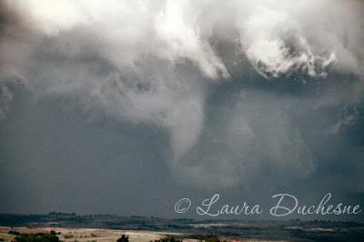
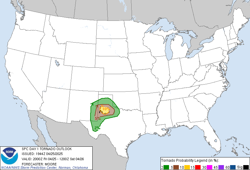
We are departing for the plains tomorrow morning for our 2 week chasecation. Today I got my serial numbers registered at Waterloo-Wellington airport, saw a nice small storm strutting its structure off this evening, and currently finishing up my packing. Check back here often for updates and some photos.
You can track us here on a spotter network map, and you can also check out my sister's blog. Wish us luck!!!
Friday, May 13, 2011
Monday, May 09, 2011
Chase 2011 Plans in the Works
So, it's a new storm chase season already - how the time flies! This year, I'll be chasing with my friend Tom Stefanac and my sister for about 2 weeks. We'll be departing from southern Ontario on May 13th... which happens to fall on a Friday.... perhaps a good omen? We shall see! The GFS was showing a ridge/omega blocking pattern for our first week, but it seems to weaken and move east with each successive run, which is a good thing! While I am down in the plains, I will post updates here, so check back to keep tabs on what's new and our whereabouts.
Sunday, January 30, 2011
May 18, 2010 Dumas chase summary online
I decided to post my May 18th Dumas, TX chase summary online, complete with photos galore. The rest of 2010's chases will be online soon, stay tuned!
Saturday, July 03, 2010
Wednesday, May 19, 2010
TX panhandle tornadofest!
May 18, 2010
Chased a spectacular tornadic cyclic supercell near Dumas, TX this afternoon! Great day, no idea how many tornadoes we saw, at least 5... some I did not get to photograph and some are in question due to being rainwrapped, but overall... great day!!! Excellent wall cloud structures as well! Too tired to write up a full log, so here are some stills to tide you over for now.


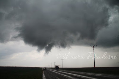


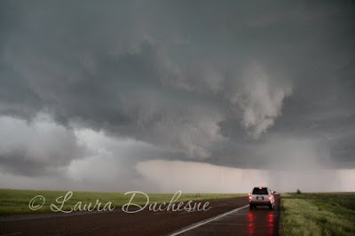
Chased a spectacular tornadic cyclic supercell near Dumas, TX this afternoon! Great day, no idea how many tornadoes we saw, at least 5... some I did not get to photograph and some are in question due to being rainwrapped, but overall... great day!!! Excellent wall cloud structures as well! Too tired to write up a full log, so here are some stills to tide you over for now.


Tuesday, May 18, 2010
Greensburg
May 13, 2010
Today was a down day, so it was time to do some needed laundry. Sandra and I went shopping for the afternoon.
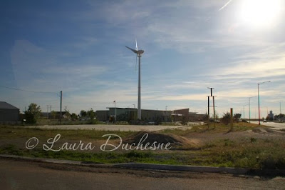
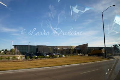
We visited Greensburg once more and had a look at the Big Well memorial for the tornado. We then headed southwest to Guymon, OK where we stayed the night.


Today was a down day, so it was time to do some needed laundry. Sandra and I went shopping for the afternoon.
We visited Greensburg once more and had a look at the Big Well memorial for the tornado. We then headed southwest to Guymon, OK where we stayed the night.


Kansas Chase
May 12, 2010
Today we were going to target south central Kansas, where the SPC issued a 10% tornado risk for the Pratt area. We made a quick stop in Greensburg. Wow has the town really come along since the last time we went through in 2008! The new hospital was very beautiful, lots of new homes, businesses and gas stations were now built. We stopped at the Dillons for a bathroom break and a snack. An older gentleman started talking to us about Greensburg. The people here are just amazing.
It was still very cool here and overcast, and the clouds were surface based. It was quite a contrast compared to the motel we stayed at in Woodward. Perhaps this temperature gradient would have a hand in the setup for later. We then headed to Pratt to hang around there for a bit. We were waiting for the warm front bulge to move up into the area. At least the overcast dull cloud was starting to break up and it was getting warmer out. There was also a boundary that was starting to bubble up. We parked at the Walmart to look at the models, then finally around 10 to 2 we decided to head towards the Hutchinson-Wichita area. On our way there, we saw a horseshoe vortex, which is a sign of wind shear. The CAPE was 4000 with a lifted index of -10. When we got to Wichita, we stayed to the west side of town, which would allow us to intercept the storms easier. There was convection already happening early in the day, and Ron was hoping for the outflow boundaries from those storms to interact with the main storms for later.
At 2:20, the SPC issued a mesoscale discussion for the Lawton-Wichita-Kansas City area. The cap was expected to break in 1-2 hours from now. A few mintues later, the first tower that we were watching was now starting to anvil out. 10 minutes later, the first tornado watch was issued from Childress through to Nebraska. Yikes what a big area! We passed the TIV 2 filling up in a gas station. Around 2:50, a severe thunderstorm warning was now issued for the storm. We turned around in Wichita to head back towards the west. At 3:20, a tonado warning was issued northwest of Wichita. The storm was along the trough, and was moving only at 20 mph.
At 3:48, while on hwy 17, we could see the shelf cloud ahead of us. It was dark underneath! When we got under the storm, we encountered some hail. We then headed north to a main highway. Unfortunately we had to cut through a dense rain core. The storm appeared to be HP (crap). It was hard to see anything! Ron said over the radio that there was going to be a good base to our north closer to Hutchinson. At 3:60, we stopped in Pretty Prairie for a brief stop, then continued north towards Hutchinson. A few minutes after 4, we were now just south of Hutchinson and the rotation was to our east. We finally started to get into some clearing! We headed east on Arlington Road. A hook echo started to form on the Baron. Things were getting exciting! Then when we finally got out of the rain, something caught our eye - a really nice funnel extending almost halfway to the ground, and rotating!!! YES! I snapped a few pictures before it roped out. I couldn't see if there was any debris under it due to some trees. Go figure, even in the plains, there is always something in the way!
We slowly continued down the road, now. The tornadic rotation was just up ahead of us, crossing the road. Oh man now my adrenaline was going! We pulled off to the side and got out quickly. HOLY CRAP! I looked straight ahead, almost above us... the clouds were spinning in a cinnamon bun swirl, AND THE NEARBY TOWN'S SIRENS WERE GOING OFF!!! We were right behind the rotation now, which was perfect! Now if only it would drop another tornado!!! I looked behind me. Crap. The precipation core was catching up to us. "Get in now!!" I yelled. Wow that was a rush. Unfortunately the core choked off the inflow to the rotation. We managed to get out of the core and I saw a couple of other chasers parked off the road watching the storm. Unfortunately, Ben seemed to have lost his wide angel lens for his HD camcorder in the midst of the rush.
We headed northeast and encountered some hail, then stopped in Halstead for a quick bite at the Subway. We were going to leave our first storm and target the one to the south now, since it was now rotating. The storm we were on was starting to become more outflow dominant. We saw some roll clouds.
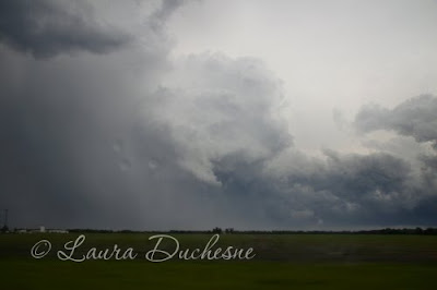
At 5:30 the gang made a stop. There was not too much going on with the storm... a bunch of scud bombs, roll clouds... mainly outflow dominant stuff. A guy that was driving by had pulled over and showed us a picture of the funnel we saw. After that, we headed east and north on 135. Off to our east, a small meso was trying to form beside a hailshaft, which made for some interesting pictures. Well, since there was not much else going on in the way of tornadoes, we decided to play in the hail, but the storm seemed to be gaining speed and we couldn't catch up to it. We gave up and turned around to work our way back to Wichita.
When we reached Florence at 6:40, we pulled into a gas station parking lot. I saw some accumulated hail in spots beside puddles of rain, so I picked up some. It was a mix of pea and quarter sized hail and showed everyone. Cold, cold, cold!
At 6:55 we saw a nice big roll cloud ahead of us, but that was pretty much the last interesting feature of the day. When we got into Wichita at 7:25, we encountered another hailcore that was estimated to be about 2 inches. Baron picked up rotation, but it didn't amount to much.
We stayed at the Econo Lodge in Wichita for the night. All in all, it was an okay day, with the best part being the funnel and rotation we saw. Apparently the funnel we saw was reported as a tornado by an emergency manager, a few miles south of Haven, which seemed to match the area we were in. Ron said he talked to a sheriff who saw the tornado. All right! That makes at least one for us!


Subscribe to:
Posts (Atom)


